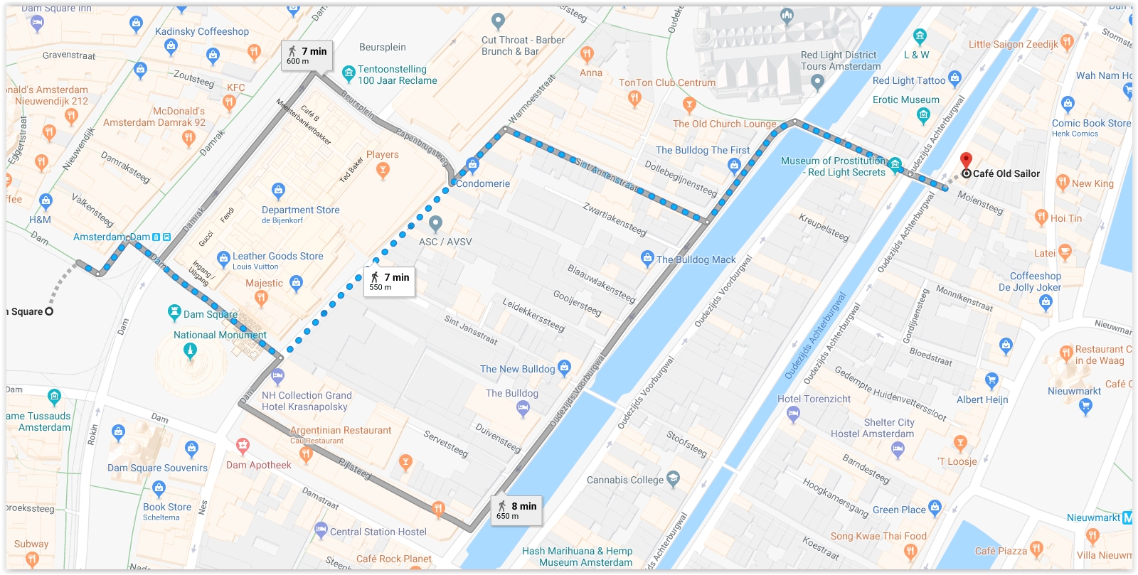
Dam Square To Red Light District Walking Map
The easiest way to get from Dam Square To Red Light District is to walk. There is no direct tram that connects Dam Square To Red Light District. The total walking distance is just over 500m so it should be an easy walk for anyone. The walk should take about 7 minutes.
Below you will find a map for walking from Dam Square To Red Light District. Beneath the map are walking directions.
Click on the map to expand to full size

Dam, 1012 JL Amsterdam, Netherlands
Red Light Distict
Oudezijds Achterburgwal 39-A, 1012 DA Amsterdam, Netherlands
